Wild South and Linville Volunteers Tackle Babel Tower Trail

This summer Wild South and Linville Area Volunteers, led by partner Kevin Massey, are hard at work doing some heavy maintenance on the Babel Tower trail in the Linville Gorge Wilderness. Helped out by an agreement with Wild South under the Grandfather Restoration Project, the crew is able to do some much needed work on one of the most popular trails within the Wilderness area.

Volunteers show off stone cribbing on the Babel Tower trail

Volunteers show off stone cribbing on the Babel Tower trail

Crews will be working hard out in the field this summer adding check dams and repairing drainage on steep sections of the trail, adding stone cribbing on heavily eroding sections, redefining the main trail and decommissioning user-created trails near the tower that are causing erosion into Linville River. This is one great example of partnerships in the Linville area and we are lucky to have an amazing group of partners and community volunteers who can steward the Linville Gorge Wilderness! Keep track of the progress on the Linville Gorge Maps blog at www.linvillegorgemaps.org.

Kevin’s great work in the Gorge was also recently highlighted in the Asheville Citizen Times article “Watching out over wild, picturesque Linville Gorge“.

Fire Learning Trail Launches

Visiting Linville Gorge on the Grandfather Ranger District of the Pisgah National Forest it is hard not to notice the signs of fire. From the iconic wind-whipped table mountain pines gripping the cliffs at the edge of the gorge, to the characteristic clear views, fire has shaped Linville from the beginning.

FireLearningTrail

Partnering with The Nature Conservancy, The Fire Learning Network, and the Consortium of Appalachian Fire Managers and Scientists, the Grandfather Ranger District has installed a series of informational signs along Old NC 105 on the west rim of Linville Gorge to share with the public information about fire safety, fire history, fire ecology, and firefighting. Visitors starting at the Information Cabin at the north end of Old NC 105 can visit the signs by driving south along the Fire Learning Trail as they take in the sights of the area.

The signs are accompanied by a series of pod casts featuring radio-style interviews with local fire managers that are available on iTunes (search: Fire Learning Trail) or on CDs distributed free of charge at the Linville Information Cabin.

The Fire Learning Trail is part of an effort to increase education on the history of the Grandfather Ranger District and the forces of nature that have shaped the forests. Specialists from The Nature Conservancy and the Consortium of Appalachian Fire Managers and Scientists were on hand at the Linville Gorge Spring Celebration last weekend to talk to the public about this exciting new outreach effort.

What Does Restoration Look Like? Saving Hemlocks

Hemlock Preservation from Lisa Jennings on VimeoThis highlight is part of a series of videos celebrating the mid-point of the Grandfather Restoration Project to provide folks with an inside view into what restoration looks like in the forest. 

One of my favorite camp sites when I was younger was in a hemlock grove deep in the Wilson Creek watershed, where I could cool off under the emerald green canopy and the hemlock needles were so thick that I could sleep comfortably on the forest floor. Going back to that site today, it is much different from the magical place of my memories. Now, those towering green hemlocks are dull, grey, and leafless. The forest floor is littered with fallen branches and toppled hemlock trees.

In the last decade there has been a drastic change in the forest communities of the southern Appalachians. Hemlock woolly adelgid, a small aphid-like insect from East-Asia, has decimated hemlocks in eastern North America. First introduced in a private garden near Richmond, Virginia, the adelgid has spread both north and south – from Georgia to New England.

The adelgid attaches to the base of the hemlock needles, where it feeds on the sugars that are being transported from the needles to the tree. Infested trees can be identified by the white woolly mass on the underside of the branch. Over time the adelgid starves out the hemlock, leading to defoliation and eventually death.

IMG_0663

Signs mark treated Carolina hemlock trees

Scientists have yet to find resistant hemlocks in the east, leaving active treatment as the only option to save these iconic trees. Maintaining hemlock forests is one of the main goals of the Grandfather Restoration Project, an 8-year collaborative project to restore 40,000 acres of forest on the Grandfather Ranger District as part of the national Collaborative Forest Landscape Restoration Program. Two species of hemlocks grow on the Grandfather District. The more common eastern hemlock grows in streamside forests. The rare Carolina hemlock grows on rocky outcrops. Both species are susceptible to the hemlock woolly adelgid.

The most common way to treat hemlocks for the adelgid is using an insecticide treatment. The Forest Service’s primary chemical of choice is called Imidacloprid. Imidacloprid is mixed with water and injected into the soil around the root system of a hemlock. The chemical moves into the foliage, killing the adelgids as they feed but leaving the foliage unharmed. This both maintains old hemlocks and supports regeneration of new hemlocks near the treated trees.

The other way to treat the adelgid is using a natural predator. Laracobius negrinus, a small beetle from the Pacific Northwest, is a natural predator of the hemlock woolly adelgid. Scientists at the Southern Research Station are studying how these beetles respond to the colder winters in our area, and how we can best use them.

Through the Grandfather Restoration Project, the Forest Service has treated thousands of hemlocks and partnered with leading researchers to release beetles at about a dozen locations on the Grandfather Ranger District. Although we cannot save every hemlocks, we can help preserve the species to ensure this iconic tree remains a component of the forest into the future.

Rose’s Mountain Prescribed Burn

This was the first ever burn at the Rose’s Mountain unit, which was the first unit to be burned under the new Grandfather Restoration Burns project. The ecosystem in this unit is highly fire-adapted, and was a top-ranking area to prioritize burns under the project. We had a great burn, blackening 70-80% of the unit, and meeting all objectives. Fire managers were able to keep the flames low in young pine areas to protect their growth. Firefighters also protected the Mountains to Sea trail, which received no damage in the burn. Thanks not only to our firefighters on the ground, but to all the collaborative members who helped guide the Restoration Burns project! We are excited to be able to restore these areas. This unit in particular has Fire Learning Network vegetation monitoring plots that will be monitored under the CFLR agreement with Western Carolina University.

IMG_20160309_171620739_HDR

Date: March 9-10
Size: 3,100 acres
Location: North of Morganton, NC, South of Table Rock
Purpose: Restoration of fire-adapted communities, fuels reduction
Partners: The NC Forest Service, The Nature Conservancy, North Carolina Wildlife Resources Commission, North Carolina Department of Transportation, and Burke County Emergency Management

What Does Restoration Look Like? Shortleaf Pine at Roses Creek

Shortleaf Restoration from Lisa Jennings on Vimeo — part of a series of videos on restoration celebrating the mid-point of the Grandfather Restoration Project.

Forest restoration is something that is talked about a lot these days. But what does restoration really look like on the ground? 2016 marks the halfway point in the project. In the past 4 years, Forest Service managers have been working with a group of partners to improve forest health on over 27,000 acres. One of the key projects the Forest Service has led is the shortleaf pine restoration work at Roses Creek, near Morganton, NC.

Shortleaf pines are a southern yellow pine that grow at lower elevations on the rolling slopes where the foothills meet the Appalachian Mountains. Shortleaf pine forests contain not only shortleaf pines, but a mix of oak species that benefit wildlife as well as other southern yellow pines. The stands are typically open – more like a woodland than a dense forest – and contain a rich understory of grasses and forbs. Historically, shortleaf pine forests were common on the dry, south facing slopes of the Grandfather Ranger District. Today, they are scattered across only a small percentage of the district.

Past records show that this forest type supported a wide variety of plant and animal species. Shortleaf pine forests in the Southern Blue Ridge once supported rare species like red cockaded woodpecker as well game species like bobwhite quail. But, the forests were hit hard on several fronts. First, much of the forest was lost with land clearing – which was common on these rolling slopes in the early 1900s. Next came fire suppression – without frequent fire the fire-loving oaks and pines were overtaken by yellow poplars and maples. The final hit was the southern pine beetle outbreaks in the 1990s which swept through the area, killing many of the remaining shortleaf pines.

Partners discuss shortleaf pine restoration near Roses Creek (photo by Adam Warwick, TNC)

Partners discuss shortleaf pine restoration near Roses Creek (photo by Adam Warwick, TNC)

The Roses Creek shortleaf pine restoration site provides an opportunity for these pine forests to come back to life. Last year, the Forest Service brought in local loggers to do a restoration harvest. Select yellow pine and oak trees were left in the overstory to provide structure and a seed source. After the harvest, the Grandfather Ranger District fire staff conducted a prescribed fire to prepare the seed bed. Southern pine seeds germinate best where there is little leaf litter, and burning will knock back some of the competing trees and shrubs. The final step is planting shortleaf pine seedlings in between the remaining trees to add to the seed source from the few existing shortleaf pines.

The Roses Creek site is just one example of shortleaf pine restoration under the Grandfather Restoration Project. Managers are working to restore the system so that rare plants and animals will return to the area, and future generations will be able to enjoy the unique and beautiful shortleaf pine forests. 

Wildlife and Prescribed Fire

Prescribed fire is an important tool for achieving the restoration goals of the Grandfather Restoration Project. Not only does the use of a low-intensity fire reduce fuels that lead to dangerous wildfires, but it also allows managers to restore fire-adapted forests.

Although burned areas can appear bare and inhospitable at first, low-intensity fire benefits the forest by increasing plant diversity, making important nutrients available to plants, allowing oaks to germinate, and providing food for wildlife. Animals are used to fire – they return to the area quickly, and plants regrow even faster than before the burn. Check out this cool time-lapse video showing what happens after a burn from the Clinchfield unit!

Clinchfield Wildlife Timelapse from Lisa Jennings on Vimeo.


Simpson Creek Watershed Improvement Project

We are excited to share the progress for the Simpson Creek project on Rose’s Creek Rd (also referred to as Table Rock Rd). What was once a small, elevated culvert is now a large aquatic organism passage big enough to drive a car through! This project provides native species with a way to move up and down stream while maintaining the natural stream channel and accommodating large flow events. The project also restored the riparian area above the road, which included bank reconstruction and planting native vegetation.

Simpson Creek Aquatic Organism Passage

Simpson Creek Aquatic Organism Passage

Planning for the Simpson Creek Watershed Improvement Project started in 2013. This CFLR project is part of a larger effort to improve watershed health on the Pisgah and Nantahala National Forests. In addition to the new passage and restored riparian area, road drainage in the area was improved with 7 new and 3 improved drainage relief pipes. Log vanes were installed in the stream channel to provide structure. The final phase of the project will improve a tributary to Simpson Creek by stabilizing the headcut, an erosion-caused feature where the bank drops off sharply causing sedimentation in high-flow events.

Detail of location and culvert before the project

Detail of location and culvert before the project

Fighting Fire with Fire: Prescribed fires slow wildfire spread

The call came in at 3pm on a clear, hot Saturday in the middle of July: “We’ve got a report of smoke on Bald Knob north of Lake James.” For those of us responding that day, we had no idea we would be working on the wildfire in the summer heat for nearly a month.

Smoke visible just west of Bald Knob

Smoke visible just west of Bald Knob

As a firefighter for Pisgah National Forest’s Grandfather Ranger District you become intimately familiar with the lay of the land. Some areas evoke fond memories – rolling hills, majestic forests, bubbling brooks. Bald Knob is not one of those areas. The terrain west of Bald Knob is unforgiving. Steep slopes end in sheer cliffs. Thick evergreen shrubs and piled downed trees force you to crawl on hands and knees to get around.

But the area around Bald Knob was not always so unforgiving. Decades of fire suppression and widespread damage from the southern pine beetle outbreak of the late 1990’s changed the structure of the forest. What was once pine-dominated woodland with an open, grassy understory became choked with ingrowth over the years, leading to dangerous wildfire conditions.

Responding to the wildfire that hot, July afternoon, fire managers had a tough decision. Do you send your firefighters miles off trail to dangerous conditions to suppress a lightning fire in an ecosystem where fire would naturally occur? Or do you fall, back, manage the fire, and risk it moving towards private property?

Managers ultimately decided to manage the fire, allowing it to move naturally through the terrain. There was one key consideration that played into the decision – the existence of prescribed fire restoration units on the west, south, and east sides of the fire.

The decision lay with the District Ranger, Nicholas Larson. “We realized from start that this ignition was in a very difficult place to access.  Considering the heavy fuels and inability to use equipment in this type of terrain we knew suppression tactics would have a low probability of success,” Larson said.  “Pair all that with the fact that we have restoration treatments all over this ridge and it really was a great opportunity to step back and think about the appropriate response.”

Lake James Prescribed Burn - January 2015

Lake James Prescribed Fire – January 2015

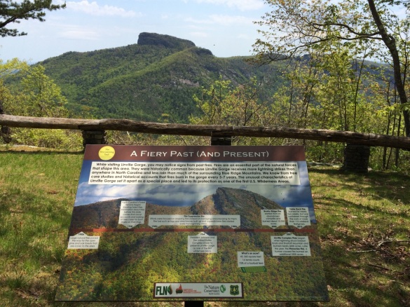
Prescribed fire has been used as a tool to reduce wildfire risk and restore forest structure in the Southern Appalachians since the mid 1990’s. In fire adapted areas like Bald Knob, wildfire would historically occur every 5-10 years, reducing fuels from leaf litter, sticks, and logs that build up over time. These natural wildfires have been suppressed since the 1940’s.

Under the Grandfather Restoration Project, part of the Forest Service’s Collaborative Forest Landscape Restoration Program, the Grandfather Ranger District has increased the number of acres managed for fuels reduction 6-fold. Recent prescribed burns around Bald Knob were critical in slowing the spread of the fire. These treatments allowed the response to this wildfire to be one that focused on restoring fire adapted ecosystems and reducing fuels, without putting firefighters at risk.

Fire activity increased on the Bald Knob Fire as the long, hot July days crept into August. The prescribed fire units on the west, south, and east sides allowed firefighters to focus on keeping the fire off private property on the north end of Bald Knob. When the rains finally came in mid-August, the fire had burned over 1,200 acres. No structures were lost. No firefighters were injured.

Last week the Forest Service released a report detailing the effectiveness of the surrounding fuel treatments in managing the Bald Knob Fire.

With increased population growth in the Southern Appalachians, prescribed fire will continue to be an important tool in preventing wildfire spread. The Forest Service prioritizes burns where they can do the most good to reduce fuels, restore structure, and minimize risk to private property. We live near our National Forest because it provides the perfect setting for a mountain home. No one wants to lose their home in a wildfire. As we move into the winter fire season, rest assured that managers are out in the woods proactively fighting wildfire through fuel reduction treatments, restoration, and prescribed fire.

Partners Make Big Contributions in 2015

Partners are critical to the success of the Grandfather Restoration Project. The partners are not only an important part of the collaborative planning process, but they play a big role in implementing the work on the ground. In FY2015, partners worked over 8,000 hours on the Grandfather Ranger District for a total value of over $200,000! Below is the partner match work that was reported for the 2015 CFLR annual report.

Habitat Restoration:

  • The North Carolina Wildlife Resources Commission supported wildlife activities across the district, including stocking of 4,000 native trout, mowing of 375 acres of wildlife openings, and 13 habitat surveys.

Invasive Species Treatments:

  • Wild South worked for over 500 hours on invasive species eradication, focusing on Paulownia, within the Linville Gorge wilderness and outside the wilderness within the Table Rock fire area.
  • The Wilderness Society assisted in preparing reports for Hemlock Wooly Adelgid treatments.
  • Wild South inventoried hemlocks needing treatment in Linville Gorge.

Trail Restoration:

  • The Friends of the Mountain to Sea Trail volunteers worked over 1,800 hours on trail maintenance for the Mountain to Sea Trail. Friends of Linville Gorge and Gorge Rats volunteers worked over 1,300 hours on trail maintenance in Linville Gorge Wilderness.
  • The Linville Gorge Mapping project worked over 1,000 hours on a comprehensive trail and ecosystem mapping project in the Linville Gorge.
  • The Southern Area Wilderness Stewards worked over 800 hours in addition to contracted work on trail maintenance within the Linville Gorge Wilderness.
  • The Vermont Youth Conservation Corp provided matching funds for the relocation of the China Creek Trail

Prescribed Fire:

  • The Nature Conservancy provided support for fire implementation with 2 qualified firefighters as well as education and outreach with the creation of a “Fire Learning Trail” of interpretive signs and accompanying social media.
  • The North Carolina Forest Service and the North Carolina Wildlife Resource Commission provided support for prescribed fire implementation and participated in joint-agency landscape burns.

Timber and Silviculture:

  • Partners, including MountainTrue and The Nature Conservancy, provided support for identification of future project sites to be implemented under the new Farm Bill CE authority for Southern Pine Beetle recovery.

Monitoring:

  • Following the Lake James Prescribed burn, collaborative members from The Nature Conservancy and NC Wildlife Resources Commission completed immediate post burn monitoring following the Southern Blue ridge Fire Learning Network methodology.
  • The Wilderness Society continued work on fire effects monitoring in the Linville Gorge Wilderness with a Duke University Masters Student. The data, collected in FY2014, fed into the analysis and thesis, completed in FY2015.
  • MountainTrue and Forest Service botanists monitored invasive species treatment effectiveness in the Wilson Creek area following treatments. Invasive species monitoring was also completed in the Blue Gravel Fire area and the Bald Knob Fire area, as well as the Roses Creek Timber Sale area.
  • In FY2015, an AmeriCorps intern at Mountain True analyzed the camera data collected in FY2014 and provided results showing that more animals use the burn units (both more in numbers and higher diversity of species). However, due to the small sample size no statistically significant results could be determined.

P1000746

Grandfather Project Highlighted in USDA Report

On Tuesday, USDA released a Forest Service report that documents the significant efforts to increase the pace and scale of restoration on the landscape to create resilience within forests and natural resources. The report highlights the extensive work the Forest Service has undertaken over the last few years to confront serious challenges facing forests and grasslands.

The first initiative that is highlighted is the Collaborative Forest Landscape Restoration Program, with a spotlight on the Grandfather Restoration Project. Out of 20+ projects across the country, the fact that we were chosen as the highlight in this high-impact report says a lot about the hard work and great collaboration here on the Grandfather!

USDAreportGrandfather Restoration Project North Carolina: The Grandfather Collaborative Forest Landscape Restoration Project brings together diverse partners to restore the forest health and resilience of a unique section of the southern Blue Ridge Mountains. The project is reducing fire risk, removing invasive species, improving wildlife habitat, and increasing recreation opportunities. One of the project’s many successes is the work across ownerships to remove Japanese knotweed from the Wilson Creek Wild and Scenic River Corridor. This invasive plant species takes over riparian areas, competing with native vegetation and reducing the quality of trout habitat in the waters of Wilson Creek. Successful treatment of Japanese knotweed requires removing the plant from both the National Forest System and privately owned land in the river corridor. The Forest Service, North Carolina Wildlife Resource Commission, and the partner group Friends of Wilson Creek are working on National Forest System lands and with private property owners to remove Japanese knotweed, with plans to eradicate Japanese knotweed from the area by 2017.

Check out the full report here: From Accelerating Restoration To Creating and Maintaining Resilient Landscapes and Communities Across the Nation