Thriving After Fire – Rare plants and the biologists who search for them

Fire Adapted Hudsonia montana, mountain goldenheather, thrives after wildfires on Shortoff Mountain in the Grandfather Ranger District.  Cooperation between the US Forest Service, US Fish and Wildlife Service, and The Nature Conservancy helps document their persistence following spring fires.  

Three liters of water barely made a dent in my thirst the first hot September day of monitoring rare plants on Shortoff Mountain.  So, the second day I brought 4 liters and an umbrella to create my own shade.  As we walked in silence, dripping with sweat, back down to the truck, my pants were shredded at both knees from crawling through thorny brush and my umbrella was broken on one side.   But I was smiling.

Earlier that day we had spent hours walking near the edge of Shortoff Mountain in Grandfather Ranger District looking for – and finding in abundance – Hudsonia montana.  This scrubby little plant, commonly known as mountain golden heather, clings to the rocks almost as close to the edge of a cliff as one can get.  It’s a dare devil plant sending USFS botanist, Gary Kaufman, into billy-goat mode as he very carefully picks his way up the cliff side counting plants.

Our goal was simple: use the maps created previous years to visit the areas on Shortoff mountain known to have the golden heather, count the patches of plants using a size-class system and help estimate their current numbers.  But why do this now, on a hot September day when summer seems never ending?  Because the plants were burned earlier this year by wildfires and biologists charged with protecting this federally listed species need to know the impacts of the fire.

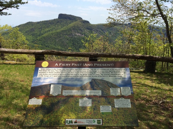
Shortoff mountain has burned on average at least once every decade for hundreds of years.  It’s prominent rock outcrops, Table Mountain pine, and bunchgrasses are adapted to the frequent lightning-ignited fires.  The little plant we were looking for, Hudsonia, is no different.  It thrives in this fire adapted ecosystem and has found its niche, only growing in two counties in North Carolina.  In past years there have been dramatic increases in the plants post-fire.  It’s kind of like how cutting your grass with a lawn mower helps the grass grow back thicker.  Except in this case, Hudsonia grows back after fire and creeps further into and over neighboring rocks and mossy areas.

Once we got back to the truck the second day, botanists from the USFS and US Fish and Wildlife Service planned to come back for a third day to sample a few more areas of plants.  What we had seen so far was promising, as expected the Hudsonia as well as other fire adapted plants like little bluestem were growing well.  I hope you enjoy this short video showing the Hudsonia and the plants on Shortoff thriving after the spring wildfire.


Fire Learning Trail Launches

Visiting Linville Gorge on the Grandfather Ranger District of the Pisgah National Forest it is hard not to notice the signs of fire. From the iconic wind-whipped table mountain pines gripping the cliffs at the edge of the gorge, to the characteristic clear views, fire has shaped Linville from the beginning.

FireLearningTrail

Partnering with The Nature Conservancy, The Fire Learning Network, and the Consortium of Appalachian Fire Managers and Scientists, the Grandfather Ranger District has installed a series of informational signs along Old NC 105 on the west rim of Linville Gorge to share with the public information about fire safety, fire history, fire ecology, and firefighting. Visitors starting at the Information Cabin at the north end of Old NC 105 can visit the signs by driving south along the Fire Learning Trail as they take in the sights of the area.

The signs are accompanied by a series of pod casts featuring radio-style interviews with local fire managers that are available on iTunes (search: Fire Learning Trail) or on CDs distributed free of charge at the Linville Information Cabin.

The Fire Learning Trail is part of an effort to increase education on the history of the Grandfather Ranger District and the forces of nature that have shaped the forests. Specialists from The Nature Conservancy and the Consortium of Appalachian Fire Managers and Scientists were on hand at the Linville Gorge Spring Celebration last weekend to talk to the public about this exciting new outreach effort.

Fighting Fire with Fire: Prescribed fires slow wildfire spread

The call came in at 3pm on a clear, hot Saturday in the middle of July: “We’ve got a report of smoke on Bald Knob north of Lake James.” For those of us responding that day, we had no idea we would be working on the wildfire in the summer heat for nearly a month.

Smoke visible just west of Bald Knob

Smoke visible just west of Bald Knob

As a firefighter for Pisgah National Forest’s Grandfather Ranger District you become intimately familiar with the lay of the land. Some areas evoke fond memories – rolling hills, majestic forests, bubbling brooks. Bald Knob is not one of those areas. The terrain west of Bald Knob is unforgiving. Steep slopes end in sheer cliffs. Thick evergreen shrubs and piled downed trees force you to crawl on hands and knees to get around.

But the area around Bald Knob was not always so unforgiving. Decades of fire suppression and widespread damage from the southern pine beetle outbreak of the late 1990’s changed the structure of the forest. What was once pine-dominated woodland with an open, grassy understory became choked with ingrowth over the years, leading to dangerous wildfire conditions.

Responding to the wildfire that hot, July afternoon, fire managers had a tough decision. Do you send your firefighters miles off trail to dangerous conditions to suppress a lightning fire in an ecosystem where fire would naturally occur? Or do you fall, back, manage the fire, and risk it moving towards private property?

Managers ultimately decided to manage the fire, allowing it to move naturally through the terrain. There was one key consideration that played into the decision – the existence of prescribed fire restoration units on the west, south, and east sides of the fire.

The decision lay with the District Ranger, Nicholas Larson. “We realized from start that this ignition was in a very difficult place to access.  Considering the heavy fuels and inability to use equipment in this type of terrain we knew suppression tactics would have a low probability of success,” Larson said.  “Pair all that with the fact that we have restoration treatments all over this ridge and it really was a great opportunity to step back and think about the appropriate response.”

Lake James Prescribed Burn - January 2015

Lake James Prescribed Fire – January 2015

Prescribed fire has been used as a tool to reduce wildfire risk and restore forest structure in the Southern Appalachians since the mid 1990’s. In fire adapted areas like Bald Knob, wildfire would historically occur every 5-10 years, reducing fuels from leaf litter, sticks, and logs that build up over time. These natural wildfires have been suppressed since the 1940’s.

Under the Grandfather Restoration Project, part of the Forest Service’s Collaborative Forest Landscape Restoration Program, the Grandfather Ranger District has increased the number of acres managed for fuels reduction 6-fold. Recent prescribed burns around Bald Knob were critical in slowing the spread of the fire. These treatments allowed the response to this wildfire to be one that focused on restoring fire adapted ecosystems and reducing fuels, without putting firefighters at risk.

Fire activity increased on the Bald Knob Fire as the long, hot July days crept into August. The prescribed fire units on the west, south, and east sides allowed firefighters to focus on keeping the fire off private property on the north end of Bald Knob. When the rains finally came in mid-August, the fire had burned over 1,200 acres. No structures were lost. No firefighters were injured.

Last week the Forest Service released a report detailing the effectiveness of the surrounding fuel treatments in managing the Bald Knob Fire.

With increased population growth in the Southern Appalachians, prescribed fire will continue to be an important tool in preventing wildfire spread. The Forest Service prioritizes burns where they can do the most good to reduce fuels, restore structure, and minimize risk to private property. We live near our National Forest because it provides the perfect setting for a mountain home. No one wants to lose their home in a wildfire. As we move into the winter fire season, rest assured that managers are out in the woods proactively fighting wildfire through fuel reduction treatments, restoration, and prescribed fire.

Faces of Fire: Wildland Fire Engines

It has been a BUSY fire season for all the folks on the Grandfather Ranger District who are involved in fire management. With fires burning on our district earlier this summer, and an intense fire season out west, we have had a lot of employees out on fire assignments (myself included).

There are many functions for fire personnel working on large fires, from those on hand crews digging lines, to firefighters working on fire engines, to finance personnel, to command staff. My job on large fires is as a Public Information Officer. Public Information Officers work to provide up to date fire information to local communities and media, as well as provide a look into the world of wildland firefighting.

One of the videos that I made while working on the Bald Knob wildfire on the Grandfather Ranger District looked at a National Forests in North Carolina type 6 wildland fire engine. This engine is used for wildfire and prescribed fire on our district. It is very different than the typical large structure-protection fire engines we see driving around town! Grandfather Ranger District Employee and Engine Boss Renardo Knight shows us around his engine in this video. Check it out!

The National Cohesive Wildland Fire Management Strategy

One of the goals of the Grandfather Restoration Project prescribed fire program is to reduce wildfire risk. While this is a local goal, it is also being emphasized both regionally and nationally. The National Wildfire Management Cohesive Strategy, often simply referred to as Cohesive Strategy, is an effort on behalf of federal, state, local, and tribal governments and non-governmental organizations to collaboratively address growing wildfire problems in the U.S.  It is a strategic push to work collaboratively among all stakeholders and across all landscapes, using the best science, to make meaningful progress towards the three goals:

  1. Resilient Landscapes
  2. Fire Adapted Communities
  3. Safe & Effective Wildfire Response

The vision of Cohesive Strategy is “to safely and effectively extinguish fire when needed; use fire where allowable; manage our natural resources; and as a nation, to live with wildland fire.”

In the last few years, more than 1000 individuals have provided comments, participated in forums, meetings, or responded to online survey requests which have helped guide the Cohesive Strategy process in the Southeast. Direction for the implementation of Cohesive Strategy in the Southeast comes from the Regional Action Plan. The plan contains 23 actions with 124 separate implementation tasks, grouped around five values and a set of identified barriers to success.  A selection of the Regional Action Plan items which relate to the goals of the Grandfather Restoration Project’s focus on ecosystem restoration and the utilization of prescribed fire include:

  • Support the creation of tools to better inform decision making processes and localized trade-off analysis for all levels of fire and land managers as well as planners and policy makers (what specific data means to managers, not just regional analysis of these data).
  • Develop and sustain capability and capacity requirements to plan and carry out landscape treatments, including prescribed fire.
  • Increase public awareness to ensure public acceptance and active participation in achieving landscape objectives.
  • Encourage planning efforts across landscapes between practitioners and land managers to address wildland fire, landscape resiliency and community safety while balancing other concerns and emphasizing plan development in high risk areas.
  • Work with regulatory agencies and entities (i.e., air quality) to ensure that prescribed fire remains a viable management tool and maximize flexibility for its use (including liability issues).
  • Encourage greater public smoke awareness through outreach and understanding.
  • Control invasive species that alter fire regimes and ecosystem function.
  • Support efforts to increase prescribed burning for ecosystem restoration.
  • Promote and use fire to emulate natural disturbance patterns to maintain and improve ecological systems, balancing social, cultural, and economic needs, especially over large contiguous landscapes.
  • Remove policy barriers and process complexities which affect the ability to effectively and efficiently share resources, not only for wildfire, but for fuels and prescribed fire work

Achievement of the Regional Action Plan is a lofty endeavor that will no doubt take extraordinary collaboration, which is the primary intent behind Cohesive Strategy. To read more about regional Cohesive Strategy efforts click here.

Lightning Strikes Increase with Climate Change

Every year, lightning caused fires burn an average of over 250,000 acres in the Southern US. Climate Scientists studying atmospheric chemistry recently released a study in Science looking at how increasing temperatures with global climate change will affect the frequency of cloud-to-ground lightning. Hotter temperatures generally lead to increased thunderstorm activity. Results indicate a 50% increase in cloud to ground lightning strikes by 2100.

“All Global Climate Models (GCMs) in our ensemble predict annual mean lightning-strike frequency in the United States to increase, with a mean increase of 12% per °C. The standard deviation of the ensemble’s predictions is 5% per °C; therefore, we can conclude that the rate of cloud-to-ground lightning strikes over the US is likely to increase as a function of global mean temperature at a rate of 12 ± 5% per °C. Overall, the GCMs predict a ∼50% increase in the rate of lightning strikes in the US over the 21st century.”

Currently, the Southern Appalachian region receives 6 to 9 cloud-to-ground lightning strikes per square mile every year (according to the National Lightning Detection Network). By 2100, that number is expected to increase to 9 to 13.5 lightning strikes per square mile every year.

from the National Lightning Detection Network

from the National Lightning Detection Network

Even though 90% of wildfires are human caused, this increase in lightning frequency will inevitably lead to a larger area of land burned in wildfires, highlighting the importance of fuel reducing mitigation methods like controlled burning.

View the article here: Projected increase in lightning strikes in the United States due to global warming

Fire and Invasives: The Paulownia Problem

It is well understood that wildfires can promote invasive species — where wildfires burn with high intensities, fire removes the duff and litter layer, allowing invasive species that thrive on bare soil to germinate. One of the biggest invasive culprits in this area is Paulownia tomentosa (princess tree). One Paulownia tree is capable of producing twenty million seeds per year, which are easily carried by wind and water. Once the seeds establish in bare soil, the seedlings can grow to a height of 10-ft in a single season.

With the Table Rock Wildfire that burned in the Linville Gorge last fall, monitoring and treating invasive species (including Paulownia) was identified as the top priority in the Forest Service’s response post-fire. As part of the Burned Area Emergency Response (BAER) for the Table Rock Fire resource values impacted by the fire were identified, and emergency funds were requested to treat invasive plant species. BAER is an emergency risk management tool that allows the Forest Service to respond to post-wildfire conditions that would destabilize or degrade the burned lands. Using BAER authority, the Forest Services and its partners have been monitoring Paulownia, treating infestations outside the wilderness boundary, and hand-pulling along trails within the wilderness.

Paulownia seedlings carpet the forest in areas where the Table Rock fire burned with high intensity near Chimney Gap

Paulownia seedlings carpet the forest in areas where the Table Rock fire burned with high intensity near Chimney Gap (photo by Kayah Gaydish)

Starting in August, our partners tasked with monitoring and treating Paulownia noted that there was an explosion of seedlings both inside and outside the wilderness boundary. Ben Prater and Kayah Gaydish of WildSouth, who have been leading the treatment efforts in partnership with the Forest Service, invited me out last week to see this firsthand (and put me to work to help treat the seedlings). I was amazed by the sheer number of seedlings coming up — in areas the forest is carpeted with young Paulownia. In inspecting the infestation, we could see that Paulownia occurs in large numbers only where the fire burned with high intensities. The Forest Service has mapped these areas, and luckily they only cover 8-acres (about 1/2 of a percent of the total fire area). In these areas, total canopy loss and the removal of all duff and litter provides the perfect environment for Paulownia — and thus these areas are the priority areas for treatment.

Ben Prater, Director of Conservation at Wild South, treats Paulownia seedlings with herbicide outside the wilderness near Chimney Gap

Ben Prater, Director of Conservation at Wild South, treats Paulownia seedlings with herbicide outside the wilderness near Chimney Gap

While there are some areas that burned with high-intensity outside the wilderness, much of this area lies within the wilderness boundary. Although we can treat those Paulownia seedlings that are outside the wilderness with herbicide, there is no authority to use herbicide within the wilderness. In fact, there is not even authority to hand-pull Paulownia. Without any methods to remove Paulownia from the wilderness, this invasive species would threaten native plant communities and degrade wilderness character.

In response to the infestation, the Forest Service is pursuing additional funding through BAER and authority to hand-pull Paulownia within the wilderness boundary through an Minimum Requirements Decision Guide (MRDG) and use of a Categorical Exclusion under NEPA. The MRDG, which was signed today, is a tool to assist wilderness managers in making appropriate decisions in wilderness. National Forest staff are currently gathering information to prepare a Categorical Exclusion to consider a timely and effective route to control the spread of the infestation. Once the Categorical Exclusion is signed, we will be organizing a broad-scale volunteer effort to get those Paulownia seedlings out before the leaves fall off and the sprouts become hard to identify.

So, as partners I ask you to stay tuned, because we could use all the help we can get in this time-sensitive effort! This will be a great opportunity to work together to help save the Linville Gorge, which holds a special place in all our hearts, from this aggressive invasive species.

Silver Lining Seen in Linville Gorge Wildfire

The Grandfather Restoration Project made an appearance in the Asheville, NC newspaper, The Citizen Times, for a follow up story on the Table Rock Wildfire that burned in the Linville Gorge Wilderness last November. The article was featured on the front page of the Sunday Edition of the newspaper.

Grandfather Restoration Project Coordinator Lisa Jennings inspects new growth 8 months after the Table Rock wildfire

Grandfather Restoration Project Coordinator Lisa Jennings inspects new growth 8 months after the Table Rock wildfire

The article provides a look at the aftermath of the Table Rock wildfire, and discusses the importance of fire within the Linville Gorge Wilderness area. It provides a well-rounded look at the subject, interviewing local hikers and activists as well as ecologists, and highlights the resiliency of the fire-adapted ecosystems.

Jennings thinks November’s Linville Gorge blaze offers a lesson on the benefits of fire in some ecosystems. “Hopefully it will change some people’s views about fire on the landscape.”

Read the full article on the newspaper’s website here: Silver Lining Seen in Linville Gorge Wildfire

Fuel Treatments and Wildfire Behavior: A Preliminary Report from the Rim Fire

rimfireThe Rim Fire was a wildfire in the central Sierra Nevada region, in Tuolumne and Mariposa counties of California. The fire started on August 17, 2013, during the 2013 California wildfire season. It was the third largest wildfire in California’s history, having burned 257,314 acres, and is the biggest wildfire on record in the Sierra Nevada. A widespread heat wave and drought conditions helped to spread the fire and make it difficult to combat. Also contributing to the fire was a pre-1980s policy of suppressing small natural fires. The lack of those fires created nearly a century’s worth of fuel to burn, resulting in a massive forest fire killing virtually all plant life in its path.

A recently released report from the US Forest Service and the National Park Service provides a preliminary description of how the Rim Fire affected areas differentially depending on the previous extent of land management, or lack thereof. The report looks at the interactions between the fire behavior and a select number of areas where management actions designed to mitigate wildfire and improve natural resource conditions were implemented on the Stanislaus National Forest and Yosemite National Park.

In general, it was found that where fuels treatments occurred prior to the Rim Fire, the wildfire burned with lower intensities.

“The fuel breaks played a critical role in reducing the intensity of the fire in the Pine Mountain Lake community, their purpose was to reduce fuel loads and the work done the past five to seven years made the difference,” said SWIFT coordinator Allen Johnson.

View the full report here: Rim Fire – Preliminary Fuel Treatment Effectiveness Report

Rising from the ashes: Table Rock wildfire stimulates plant growth

The Grandfather Restoration Project recently teamed up with a local journalist for the Morganton, NC newspaper, The News Herald, for a follow up story on the Table Rock Wildfire that burned in the Linville Gorge Wilderness last November.

Lisa Jennings inspects herbaceous growth 7 month after the Table Rock Wildfire (photo by Tyler Johnson, The News Herald)

Grandfather Restoration Project Coordinator, Lisa Jennings inspects herbaceous growth 7 month after the Table Rock Wildfire (photo by Tyler Johnson, The News Herald)

The article highlights the beneficial effects of fire and the need for applying prescribed fire to restore the fire-adapted communities in the Linville Gorge Wilderness Area.

“Because there is less shrub coverage (following fires), there is a lot more sunlight coming in and that will allow more herbaceous growth and the sun’s energy to reach the ground level,” Josh Kelly of Western North Carolina Alliance said. “Most of the diversity in our temperate forest is herbaceous. We have 130 species of trees in this area, but we also have 1,500 species of herbaceous plants.”

View the article on the newspaper’s website here: Rising from the ashes: Table Rock wildfire stimulates plant growth